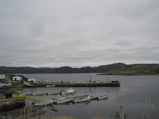
We spent the next day exploring the other two arms that make up the trident-shaped peninsula, and the various isolated communities that grace their rugged shores. We spent pretty much the whole day exploring Routes 362, 363 and 364 as they branch off the 360 to the east and west, though with constant stops the day did not feel long.
At Seal Cove, we made a long hike into the resettled community of Pass Island, but not quite long enough. We had already driven the Juke partway in down the sketchy road, likely a few deep "puddles" further than we should have, before we set out on foot....mainly for four-wheelers, rather than cars. We never did make it all the way in before we had to turn back as the return road grew long and the weather worsened. Very scenic and relaxing stroll all the same.
One other thing about this particular part of Newfoundland - the Cox name is quite prevalent. We keep hoping to discover that Jane stands to inherit an entire fishing village or small island or something.
These pictures should tell the tale, far better methinks, as words will fail.
Hermitage
Route 362
The road to Belleoram
Wreck Cove
Route 363
Harbour Breton
Deadman's Cove
The hike into Pass Island
Hermitage, Revisited
Belleoram
English Harbour West
They're everywhere!


No comments:
Post a Comment